
Blister Burn - 'Start with a Burn, finish with a Blister'
18/01/2025
Mt Aspiring National Park
17 Kilometres, 1700 Vert, 6.5 hrs
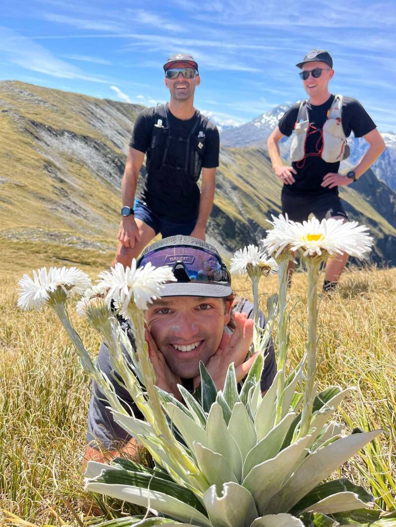
Blister Burners: Pete, Clare, Sam, Laurie, Dave, Jannik
The route: Strava Link
Stages: 6
Photo credit: Credit to all Blister Burners!

Route conception
It had almost ticked over a year since Clare, Laurie and I pulled off what we thought was a pretty unbeatable one day adventure in the hills, in the name of 'Brewstrong' - see trip report here. Clare and I had originally planned to go for a pack raft down the East Matukituki river on the Saturday, but as we looked at the weather forecast, it looked too good not to be out parading around on the tops, so the idea was started and the call out went straight to Laurie, to reassemble, and pull off 'Blister Burn'. A route that we had planned when we were looking straight across at it from Mt Armstrong one year ago, and it was only right we had a crack at it together again. I'm not sure how many times you have to do something for it to become a tradition, but twice feels like we've got a tradition going...
Like all traditions, they change, adapt and improve. The route was similar in stats, but more off the beaten track, in our heads it was anyway. Sitting just opposite Mt Brewster, the route have us leaving from the Haast Pass carpark, up over Mt Cross, up to East Peak, across to Burnt Top, and down the Wilson Ridge to Robinson Creek Carpark.
The route was set, and the last thing was to bring in a few additions to the team. And not just any additions, none other than Sam Hoskins, Dave Stephenson, and Jannik Schröder. This was a trial run for these young grass hoppers, read on to see how they held up!

Just before we got to the bushline, Sam caught his shorts on a branch and ripped a gaping hole in the arse end.. by the look of the age of the shorts, it was a matter of when not if they would go!
After a good laugh at Sam's shorts expense, and watching him tape them up with strapping tape, this set the tone for the day. Lot's of laughing.
Some of us filled up water from a marginal looking Tarn on the ridge, and continued to fast walk to the top of Mt Cross. For the first time of the day, we now had a good look at what we had coming up.
Sam made the comment to me in a sarcastic tone 'yea we're going to sidle up there, traverse around there, punch up there'. When I said, 'yes Sam, that's actually what we're doing', his face changed and realised what kind of day we were in for. A proper mission Sambo!
Stage 1: Mt Cross/Ripping Sams Shorts
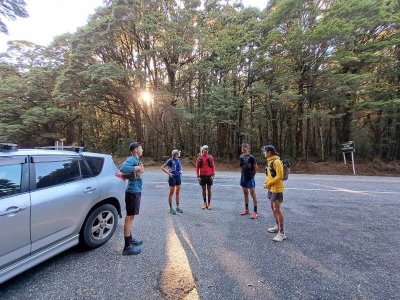
We all met for a beer the night before at b.social to go over the route, and have a bit of a catch up. Nothing much of importance was discussed other than deciding we'd take Sam and Clares double Rav 4's and roll in a Rav 4 convoy in the morning. Details were sorted.
Kicking off at 7am, the convoy commended, and we were running by 8:30am. Parking at the Haast Pass lookout carpark, we made our way up to the lookout, and started following the very nice 'unmarked' trail up to the bush line. Laurie set a good pace up the hill, and we all tucked in behind.
The birds were singing and the sun was shining, we were six happy runners setting out for an epic day!
Stage 2: East Peak
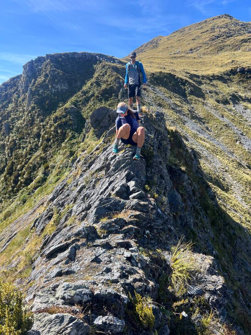
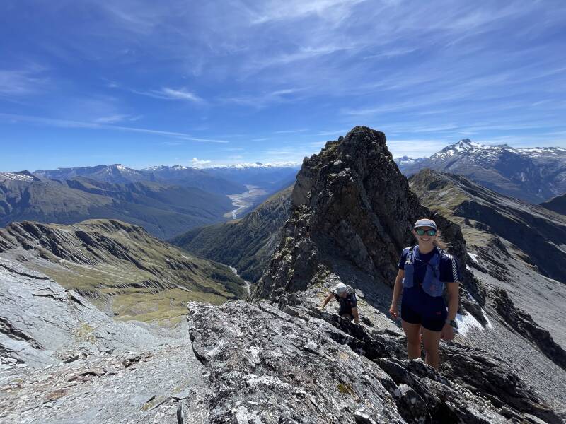
After the group had come to terms with what was ahead of us, we got on with it and started running our way down to a knife edge saddle to begin the climb up to East Peak. It was a lovely run down to the saddle, not without a few slips on the slippery dry tussock, and a bit of route finding to get onto the saddle. We eventually found ourselves carefully making our way over the knife edge saddle. Well.. I was on all fours, others (Laurie) walked across it like it was a Sunday stroll. 'I just love that stuff aye' he says to me after.
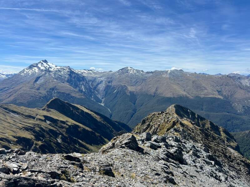
We didn’t climb to the top of East Peak, as it looked a bit ‘how ya going’ to be climbing it without helmets, due to the shitty schisty rock that makes up Mt Aspiring National Park… We did however get a beautiful view down into the back of the Burke river, down the Haast river, and up the Landsborough. We could even see mighty Mt Hooker in the distance. We were all feeling pretty bloody good at this point!
By this time, the temperature was well and truely up, almost 30 degrees in Wānaka that day. We were grateful for the gentle breeze up there to keep us relatively cool. Ready for the next assent up Burnt Top, and what looked like some beautiful ridge running to come.

We made our way up the scree slops of East Peak, with a stop off at a very small trickle of mid summer snow melt to refill our water. Water supply was slim pickings on this route, but always seemed just enough to get through on a litre at a time. We trudged up to the saddle below East Peak, and got through the rather steep section of scree slope. After looking at the face we just climbed from Mt Cross and thinking, ‘not a chance’ to getting up there and finding it not too bad at all, became a theme of the trip. ‘It will go!’ ‘It’s never as bad as it looks’ was floated a fair amount!
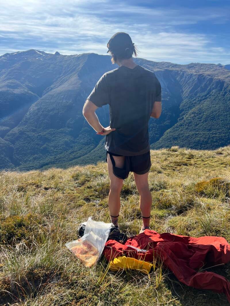
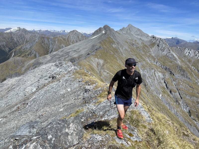
Stage 3: Burnt Top/Lunch with a view
We made our way up to Burnt Top, which was maybe my favourite climb of the day. Steep and rocky tussock climbing is one of my favourite things, not too exposed, but just enough to keep you focused and engaged with the task at hand. On arrival of Burnt Top summit, it had just gone midday and it was time for lunch. Dominoes Pizza for Sambo and I, others had more traditional wraps and sandwiches. Jannik was grateful for his one sandwich, that if it wasn’t for his partner Yas telling him before he left that morning ‘they’re all going to have sandwiches, and you’re going to be the only one without one’ then proceeding to make him a sandwich. It could have been a day of gels for him otherwise!
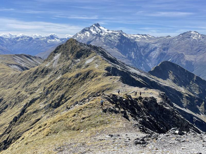

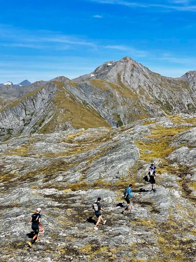
Looking North from Burnt Top, revealed the rest of our route. Glorious hero angle ridge running, with 360 views of the Aspiring National Park and into the Tai Poutini National Park. If it wasn’t for a few fluffy clouds up North, we would have been able to see Mt Cook as well.
We had an estimated timing prediction of around 6 hrs, and at this point we were on for it, we weren’t racing by any stretch, but when we were moving, we were really moving. We just didn’t know what the bush bash would be like, which could potentially blow out all time estimates if we came away second best to the bush!
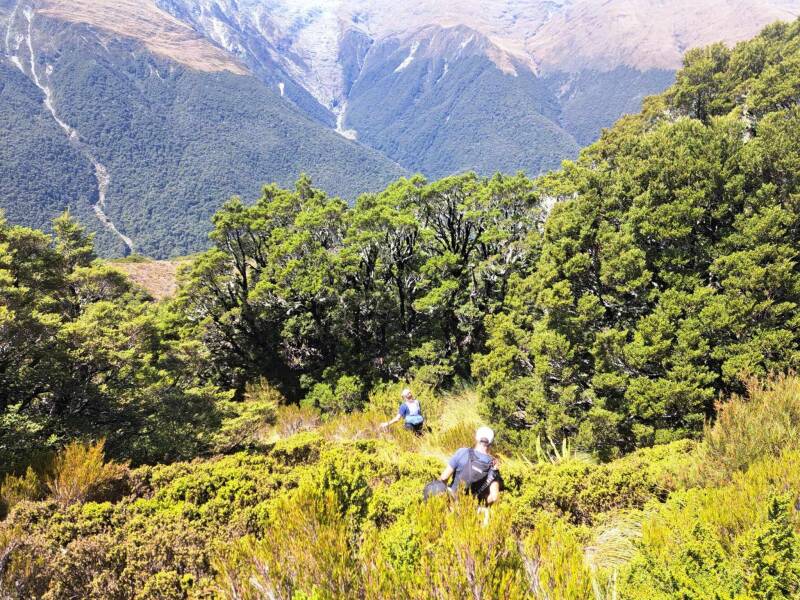
Stage 4: Mt Wilson
One of the many exciting things about this route, particularly for Jannik and I as keen canyoners, was the route took us around the back of three of the most popular canyons in the lower South Island; Cross Creek, Robinson Creek, and Wilson Creek. Three absolute classics. After spending a lot of time in these canyons over the years, it was quite something to be looking at them from the top, rather than being submerged in their cold waters below.
Mt Wilson was our last high point before dropping down into the bush. It was another lovely ascent up some steep rocky tussock, and had us feeling like we never wanted this to end! The route was just brilliant. We had so many summits, which would naturally energise us again and again. Once we got to the top, we could see the final task ahead of us, and to our delight, looked a lot better than we all expected!

We had to make the choice of whether we'd go down the Northern or Southern spur (North or South of Clutter Creek respectively). The Southern Spur would lead us onto the Robinson Creek Canyon track for the last 20 minutes, however the Northern Spur looked like it had more open travel, and sections of thin bush. We opted to press on to meet the top of the bush line for the Northern Spur. The beauty of this kind of bush bashing, is our ‘catching feature’ was the main state highway, and as long as we just kept going down hill, we would hit our target!

Stage 5: Bush Bash Bosh

A few of us, (myself included) were out of water, and the sound of a trickling stream getting closer and closer was music to our ears. We arrived at Clutter Creek, and found a lovely little steam that Jannik was quick to jump in fully clothed, and the rest of us refilled our bottles and admired our surroundings. Dappled light, blue sky above, and shimmering clear waters flowing by us.
I had many moments of gratitude on this trip, mostly for my friends that I’m able to enjoy these special places with, and this was one of them. Gosh we are lucky.
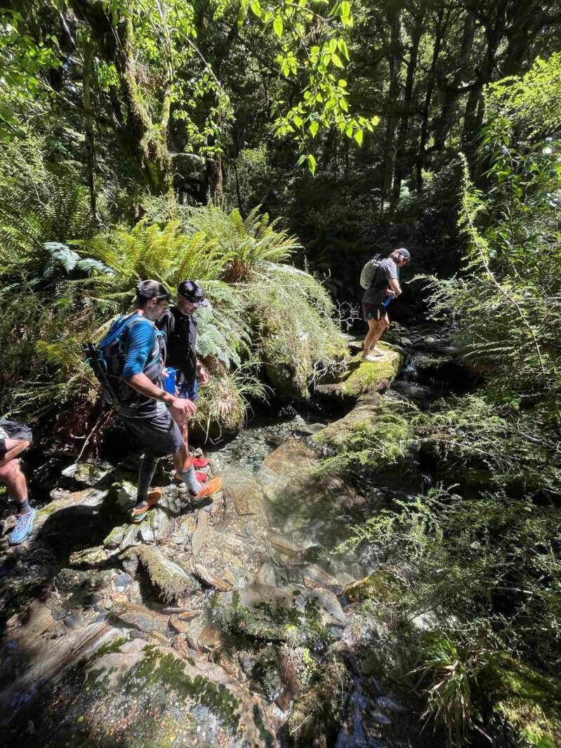
After getting through the transition zone of tussock to bush, through waste high Dracophyllum, we met the very open beech forest, with vibrant green moss underfoot. It was very pleasant travel. The bush opened up a few times early on, until we descended through the 900m contour, we were now well and truely in the bush.
It’s not often you can run off track, but in this case, we were flying down the hill (by bush bashing standards). Leaping from mossy logs to spongy cushion landings, we were having a blast. Not needing to check our maps, we were able to enjoy following our nose and problem solving our way through the green room.
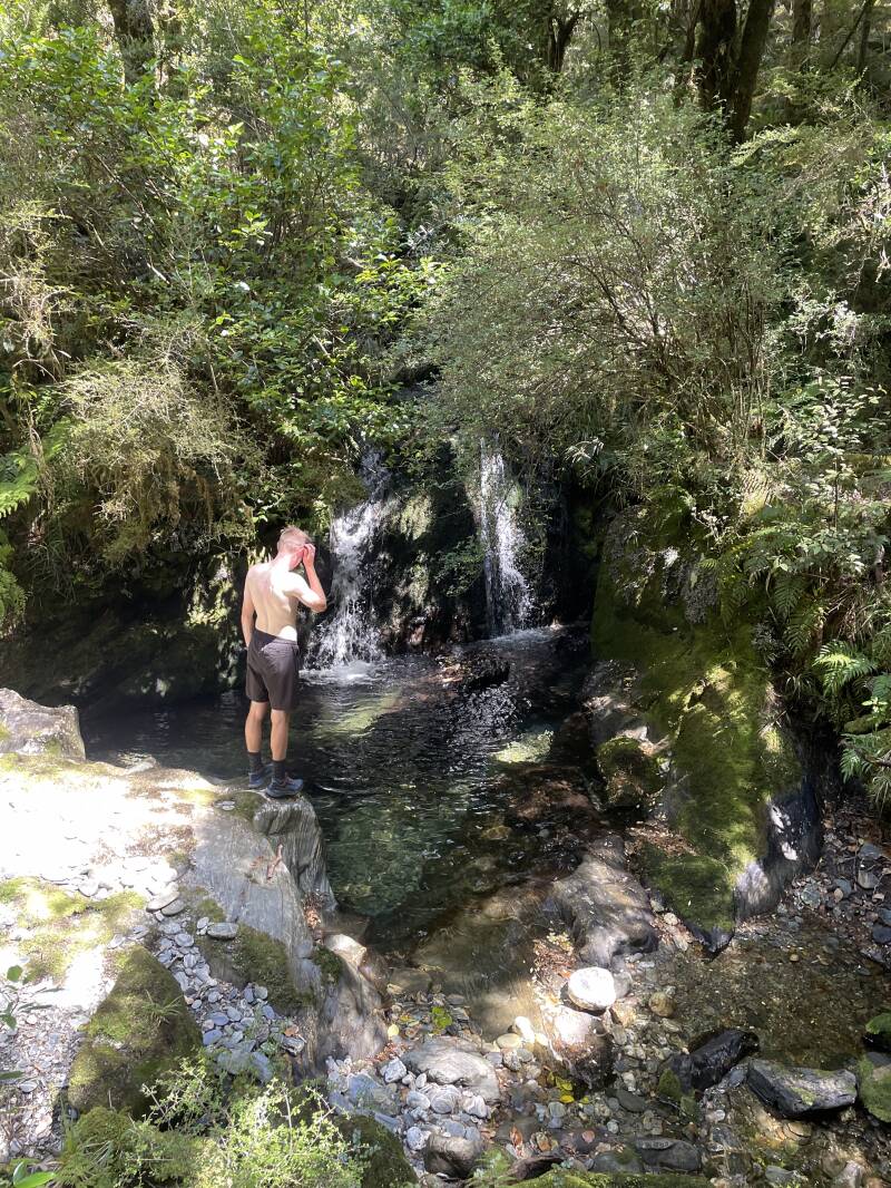
Just when we thought this couldn’t get any better, we just about reached the road, and stumbled the most beautiful plunge pool, leading into a 10 metre deep canyon, flowing out to the road.
With only 2 kilometres left of road running left, we all decided to go for a refreshing dunk to round out the day.
We popped out onto the road, like deers running out of the bush onto the road in front of you when you’re driving.. we were the deer. We popped out at the Brewster Hut car park, and had a kilometre of running back to Robinson creek carpark, which was actually a nice way to end and shake out the legs.
Back at the car, it was high fives all round, and off to the pub!
Stage 6: The brew, and the planning
In tradition, we headed straight for the Makarora pub, put away a few bowls of chips, watched Jannik demolish a pie with the pie in one hand, and a bottle of T source in the other, and enjoyed a couple cold ones.
This is one of the best parts of doing missions like this with a group. Planning the next one when you’re all riding high on the last. It’s easy to let life get in the way, and let weekends pass by, without putting plans in place and making these kind of things happen. We all reflected that we don’t have to wait another year to do the next one… how about March? Yea.. let’s do the next one in March. Routes were discussed, route names were thrown around, and once again, it was the word smith Clare who put down the best name for the next trip; ‘Shrimp Tarns’. And as the rule goes, if the route has a good name, we’ll do it.
After a total distance of 17 kilometres, and 1700m vert, with 6.5 quality hours in the hills, we all agreed that this was the goldilocks distance. It doesn’t kill you mentally or physically, but it feels like you’ve done something, and the off track, new route feeling is something you just can’t beat.
Until the next one!
